
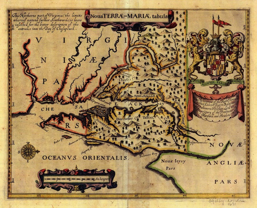
John Ogilby's map of Maryland was published as part of his America: Being the Latest, and Most Accurate Description of the New World (London, 1671). The orientation of the map showing North to the right reflects the purpose of the chart design. It is a Portolan, or port-finding chart, used by ship captains approaching the entrance of the Chesapeake Bay from the sea. The cartographer probably copied this map from Captain John Smith's influential map of 1608. Ogilby's map is noteworthy for being the first to describe the names of the counties of Maryland. In fact, Ogilby must have been privy to information from Cecil Calvert, Lord Baltimore, the Proprietor of Maryland, because Cecil County (Caecill on the map) officially was not created until 1674. The map also features the Calvert coat of arms. The quartered Calvert and Crossland arms continue to be used today as the basis of the Maryland state flag, the only state flag in the United States based on a heraldic design.
Download Map (265 KB .jpg)